

Ozark National Scenic Riverways: 10 Must-See Stops for Missouri’s Most Beautiful Drive
If you think you need to head out west to find turquoise springs, waterfalls, rugged scenery, and beautiful scenic drives, you might be surprised by what is hiding in southern Missouri. The Ozark National Scenic Riverways protects 134 miles of the Current and Jacks Fork Rivers along with some of the largest freshwater springs in the country. The area is filled with bright blue springs, historic mills, waterfalls, hiking trails, and some of the prettiest scenery in Missouri.
This national park unit is less well known than some of the big name parks out west, but it still visited by over 1.2 million people annually. While paddling on the river is the most popular activity in this region, there are many scenic spots that are a must see for families with no water access required. This guide includes our favorite places inside the Ozark National Scenic Riverways plus a few nearby stops outside of the park boundary that are an incredible addition to a Missouri Ozarks road trip.

Missouri Ozark Scenic Riverways Road Trip Overview
Time Required: 2 to 3 days suggested, can still see a lot with just one day!
Best home base: Eminence, Van Buren, or Echo Bluff State Park
Distance from St. Louis: About 2.5 hours to Eminence
Best time to visit: Spring through fall
Best scenic road: Highway 19
Cost: There is no entrance fee for the Ozark Scenic Riverways or Missouri State Parks!
Alley Spring
The Alley Spring Mill is one of the most photographed spots in the Ozarks. The contrast of historic red mill against the turquoise blue spring waters is postcard perfect.

The mill was first constructed in 1893 and is located just west of Eminence. The adjacent Alley Spring provided a constant water power source with its average flow of 81 million gallons a day. The mill became the center of a small community. Today, only the mill and the one room schoolhouse remain.
Activities and amenities
Tour the Mill – Visitors can tour the historic Alley Mill and see the equipment once used inside. You can also stamp your National Parks Passport book, buy a souvenir, and learn more about the history of the area.
Alley Mill is generally open from Memorial Day weekend through October 31. Current summer and fall 2026 hours are 9:00 a.m. to 5:00 p.m. daily through October 31. The mill is open until 7 p.m. on Sundays through Labor Day. The doors of the one room school are often open as well to take a peek inside this historic schoolhouse.


Hiking – The mill itself can be viewed by walking along a short paved path from the parking area and over a footbridge. The 1/3 mile Spring Branch trail starts behind the mill and circles around the spring pond.
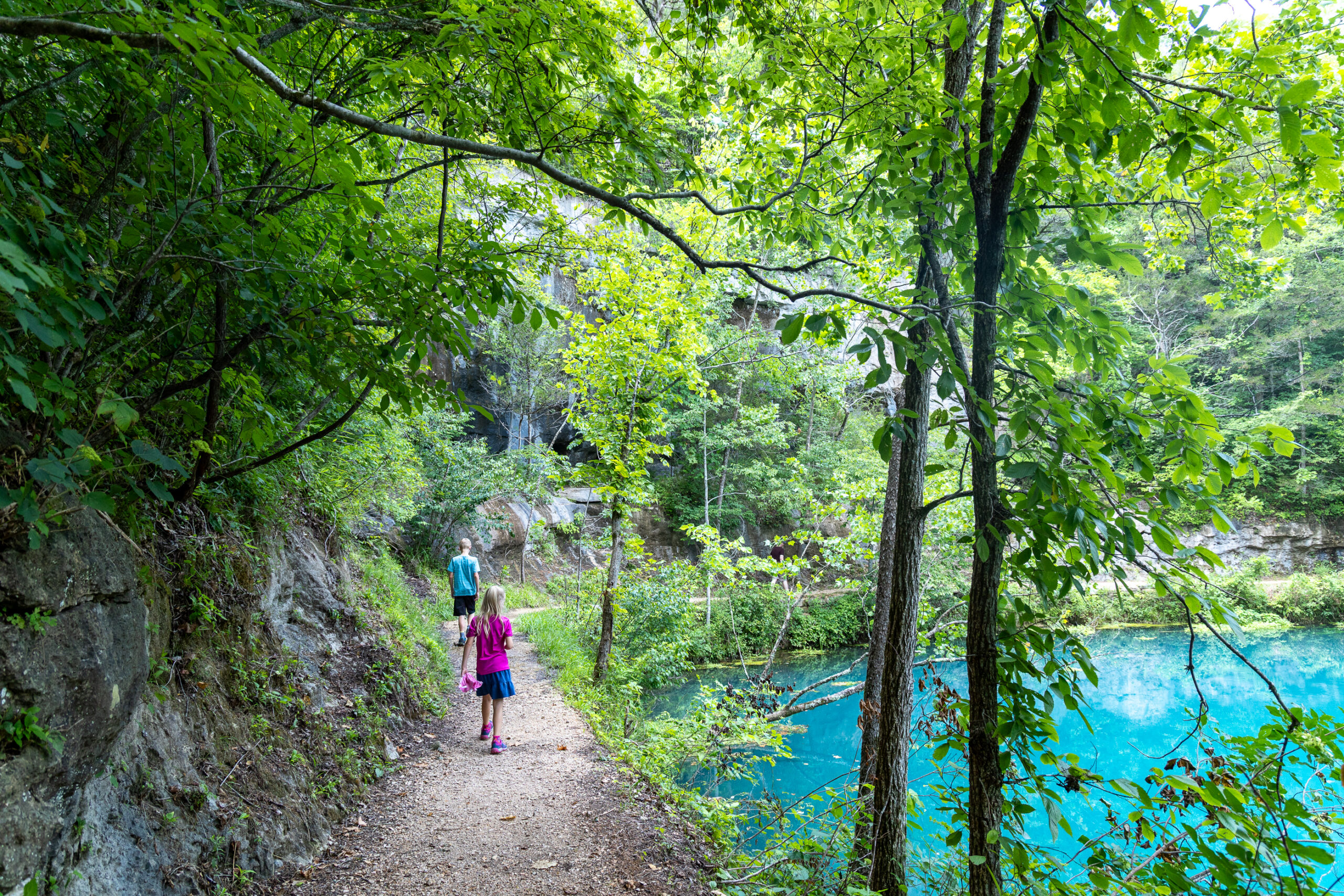
The 1.5 mile Overlook Trail also starts behind the mill. This trail is more rugged and climbs above the bluffs for a great view from above of the mill and spring.

Picnic Areas – There is a nice picnic area near the main parking area.
Restrooms – Located both near the main parking lot and at the picnic area.
Camping – Alley Spring has a campground with both sites for tents and RVs.
Directions: Alley Spring is located about 6 miles west of Eminence along Highway 106. From Eminence, travel west on Highway 106 for about 5.5 miles. After crossing the Jacks Fork River, watch for the parking area on the right.

Big Spring
Located near Van Buren, Big Spring is the most impressive of all of Missouri’s Springs. One of the largest springs in the whole country, Big Spring pumps out an average of 286 million gallons a day.

Big Spring became one of Missouri’s first state parks before joining the Ozark National Scenic Riverways. In the 1930s, the Civilian Conservation Corps established a camp at Big Spring. The CCC performed extensive infrastructure work on the park. The CCC also constructed a beautiful stone and log dining lodge and cabins that still stand today. The lodge and cabins are undergoing a multi-year extensive renovation project with a tentative completion date of 2026 or 2027.

Activities and amenities
Hiking – There quite a few trails around Big Spring. The wheelchair and stroller friendly 1.2 mile Slough Trail starts just north of the spring and connects to the 1.8 mile Rivers Edge Trail. The Spring Branch Trail is a popular 1 mile loop around the spring. For views from above the spring, try the 1.2 mile Stone Ridge Trail. If you want a longer hike, there are several more trails to choose from.

Picnic Areas – There are several pavilions around Big Spring as well as numerous picnic tables.
Restrooms can be found scattered throughout.
Camping – Big Spring has a campground with both sites for tents and RVs.
River access is available near the campground.
Directions: From Van Buren, take Highway 103 south from Highway 60. Follow Highway 103 for roughly 3 miles to the Big Spring area.

Blue Spring
Blue Spring was called “Spring of the Summer Sky” by Native Americans and its easy to see why. At over 310 feet deep, the spring emerges into a pool of water so vivid in color that is has to be seen to be believed. Just know that swimming or entering the spring is not allowed!

Blue Spring takes a little more effort to reach than the other springs, but it is well worth the drive to visit as it is one of the most beautiful places in all of Missouri.

Activities and amenities
Hiking – The trail to the spring is easy and a short 1/4 mile long. There is a small and shallow stream to cross over rocks or a log and a couple of rocky sections, but the trail is flat. An additional path continues 1/2 to the Powder Mill campground.
Picnic Area – There are several picnic tables near the parking area.
Restrooms – A vault toilet is located at the parking area.
Directions: Blue Spring is located east of Eminence. From Highway 106, turn onto County Road 535 and follow the gravel road approximately 2.5 miles to the parking area.
The gravel road includes a steep section and is not recommended for RVs. We have driven it in a regular passenger vehicle without an issue under normal conditions, but gravel road conditions can always change after storms or heavy rain.
Rocky Falls
Located off NN east of Eminence, Rocky Falls is the perfect place for the whole family to enjoy some water play. This scenic waterfall tumbles 40′ down exposed rock to a pool below. Water levels can vary depending on rainfall levels.

Activities and amenities
Hiking – There are several unmarked trails that wander around the falls area. Many people like to climb up the rocks of the waterfall, but use extreme caution here especially with kids. The Ozark Trail connects from the falls to other rocky shut-ins and an old mill 6 miles further upstream.

Picnic Areas – There are picnic tables and benches near the water.
Restrooms – Vault toilets available.
Directions: Rocky Falls is located east of Eminence off Highway H and Highway NN. Follow the signs for Rocky Falls once you reach Highway NN.
Round Spring
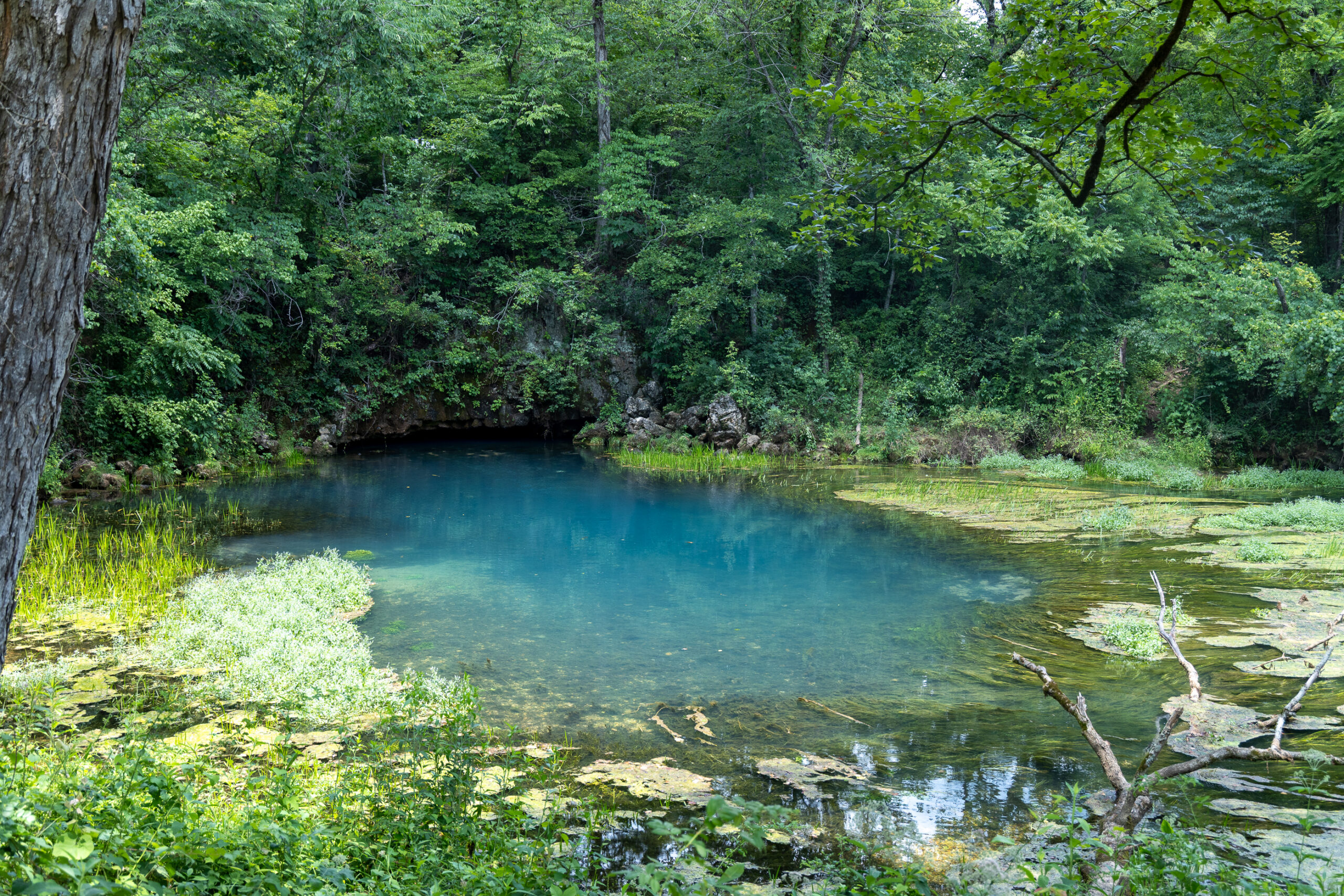
Round Spring is located about 15 miles north of Eminence, just off highway 19. This spring has an average daily flow of 26 million gallons. The spring emerges into a beautiful circular pool before flowing under a natural bridge to join the Current River.

Activities and amenities
Hiking – A 1/3 mile wheelchair accessible trail leads to the spring and an overlook platform. Additional trails including the Ozark Trail are located on the other side of the Current River.
2026 Update: The parking lot for the Round Spring Pavilion and for Round Spring itself is CLOSED for the remainder of the 2026 summer season while the low water bridge over Spring Valley Creek is rebuilt. Alternative parking near Round Spring Group Campsites 4-8 will provide trail access to the north side of Round Spring.
Picnic Areas – There is a picnic pavilion and picnic tables near the parking area.
Restrooms – Located near the parking area.
Camping – There is a campground for tents and RVs. Electric and water sites are limited.
Boating – There are several different canoe and boat launches located around Round Spring. There is also a canoe rental business along the highway just north of Round Spring.
Cave Tour – The Round Spring area also has a beautiful natural cave that is normally explored on ranger-led lantern tours.
However, Round Spring Cave is closed for the entire 2026 season. The pedestrian bridge used to access the cave was damaged during the November 2024 flood and is still being repaired.
Directions: Round Spring is located directly along Highway 19 about 12.4 miles north of Eminence.

Welch Spring
With an average flow of 78 million gallons a day, Welch Spring is a beautiful place to visit. Located near Akers off Highway K, the spring tumbles over rock debris on its way to the Current River. What makes this spring even more unique are the hospital ruins built right over the spring.

In 1913 an Illinois doctor named C.H. Diehl bought Welch Spring for $800. He believed the spring water and cool air emerging from the adjacent cave had healing properties for a variety of illnesses including tuberculosis. Dr. Diehl expanded his health resort to include cabins, a campground, and a show cave. Unfortunately, the difficulty in traveling to this remote area of Missouri at the time led to the resort failing to become a success. Once the doctor passed away in 1940, the hospital fell into ruin.
Activities and amenities
Hiking – The spring can be viewed by taking a flat and easy 0.5 mile path each way. The trail leads from the parking area along the river to the spring. You can view the spring and see the hospital ruins from the end of the trail, but you will be on the opposite side of the water from the ruins. Do not enter the spring to try and cross over to the other side.
Directions: Welch Spring is located near Akers north of the Current River. Access is from Highway K and the road leading toward the Welch Spring trailhead.
More Must-See Stops Near Ozark National Scenic Riverways
These next four destinations are not all technically inside Ozark National Scenic Riverways, but they are close enough to easily combine with the springs above for the ultimate scenic Missouri adventure.
Echo Bluff State Park
Located just north of Round Spring, Echo Bluff State Park is one of our favorite family-friendly stops in the area.The centerpiece of the park is the massive Echo Bluff towering above Sinking Creek.

The clear and shallow creek is a fun place to cool off during warmer weather. The park also has enough activities and amenities that you could easily spend several hours here. Kids will love the playground and splash pad and there are also several hiking trails to explore.


Activities and Amenities
Hiking: Echo Bluff has several trails to explore. You can also access a section of the Ozark Trail from the park.
Sinking Creek: The shallow creek below Echo Bluff is a popular spot for families to enjoy the water.
Playground and Splash Pad: The park has a large playground and splash play area, which makes this an especially nice stop when traveling with kids.
Lodging: Echo Bluff has a beautiful lodge, cabins, and campground. We have stayed here and love it as a home base for exploring the Riverways.
Dining: Creekside Grill is located inside Betty Lea Lodge and serves breakfast, lunch, and dinner.
Directions: Echo Bluff State Park is located off Highway 19 north of Eminence and just north of Round Spring.
Falling Spring
Falling Spring combines several of our favorite things to find on a road trip. You get a spring, waterfall, historic mill, and beautiful scenery all in one stop. Water pours from the spring over a rocky bluff beside an old mill. A nearby kiosk tells about the history of this area.

The amount of water flowing over the falls can vary depending on recent rainfall, so the waterfall can look very different from one visit to the next.

Activities and Amenities
Historic Mill: The mill beside Falling Spring dates to the 1920s. Spring water was once used here to power equipment for grinding corn, sawing shingles, and generating electricity.
Picnic Area: Picnic tables are available.
Restrooms: A vault toilet is available.
Directions: Falling Spring is located within Mark Twain National Forest northeast of Alton. Access requires traveling several miles on gravel Forest Service roads. From Winona, go south on Highway 19 for 10 miles, then turn left/east on Forest Road (FR) 3170. This road branches almost immediately, take FR 3164 to the left, go 2 miles on FR3164 to the picnic area. This road is generally well graded but could become rough especially when wet.
Greer Spring
Greer Spring is located farther south along Highway 19 in Mark Twain National Forest. While it isn’t technically part of Ozark National Scenic Riverways, I absolutely recommend adding it if you have enough time.

Greer Spring is the second-largest spring in Missouri with an average flow of 222 million gallons of water a day. The spring flows through a beautiful, shaded ravine before joining the Eleven Point River. This spot feels much more remote than many of the easier-to-access springs around Eminence.


Activities and Amenities
Hiking: Reaching Greer Spring requires a little more effort. The trail is about 0.9 mile each way and descends around 250 feet from the trailhead to the spring. On a hot day that climb back uphill can feel twice as long! The trail is beautiful, but allow more time here than you would for the other spring stops on this list.
Picnic Area: Picnic tables are available near the trailhead.
Restrooms: A vault toilet is available near the parking area.
Directions: The Greer Spring trailhead is located directly along Highway 19 north of Alton and just south of the Highway 19 bridge over the Eleven Point River.
Turner Mill
Turner Mill is one of the most unique historic sites we have found in the Missouri Ozarks. The mill itself is gone, but the enormous 25-foot steel waterwheel still stands in the forest near the Eleven Point River. The wheel is also all that remains of the town of Surprise which once stood here.

The waterwheel was installed in 1915 and was hauled into the remote area in sections by oxen. The nearby Turner Spring once powered the wheel and mill. Standing beside such a massive piece of machinery in the middle of the forest is pretty incredible.
Activities and Amenities
Historic Site: Explore the remains of the old mill site and see the giant waterwheel.
River Access: Turner Mill is located along the Eleven Point National Scenic River. The area is also used as a river access point. A Forest Service river guide lists Turner Mill South as seven river miles downstream from Greer Access.
Hiking: Short paths around the site allow you to explore the mill remains, spring branch, and river area.
Directions: Be sure you are navigating to Turner Mill North if your goal is to see the historic waterwheel. From Hwy 19, going north turn right onto FR 3152 for 6 miles then turn right on FR 3190 for 3 miles. The site is at the end of the road. Follow the short path to see the wheel and the spring.
This area is remote and the roads can be rough. Download directions before leaving the highway and check current Forest Service road conditions before your trip.
Things to know about the Riverways
- Cell service is spotty. Be sure to have a printed or downloaded map of the area.
- Swimming and wading are not allowed in the springs themselves. Keep a close eye on children around springs and rivers.
- Keep up to date on closures of buildings, trails, and roads on the park’s website or Facebook page.
- You can find a list of various other trails in the national park here.
- As always be sure to pack out what you bring in or use park trash receptacles.
- Bring snacks and water. Food options become much more limited once you leave Eminence and Van Buren.
Ozark National Scenic Riverways Road Trip Itineraries
There is so much to see in this area that deciding how to fit everything into one trip can be a little overwhelming. You can see several of the highlights in one very full day. However, I recommend spending at least two days if this is your first visit. Three days is even better if you want to add Greer Spring, Falling Spring, and Turner Mill without spending your entire trip in the car.
One Day Ozark National Scenic Riverways Itinerary
If you only have one day, I would focus on the area around Eminence and the Upper Current River.
- Welch Spring – Start with the easy one-mile round-trip hike to Welch Spring. You’ll get to see both the beautiful spring and the unusual hospital ruins without using up your entire morning.
- Echo Bluff State Park – Continue to Echo Bluff State Park. Walk along Sinking Creek and take in the view of the massive bluff. If you’re traveling with kids, give them a little time at the playground, creek, or splash pad.
- Round Spring – Head south to Round Spring. The walk to the spring is short, making this an easy stop to add without taking up much of your day.
- Eminence – Head into Eminence and stop for lunch
- Alley Spring – Spend more time at Alley Spring. Walk the 0.3-mile loop around the spring and explore the historic mill. If you have enough time, add the 1.3-mile Overlook Trail for the view from above.
- Blue Spring – If you still have enough daylight, finish at Blue Spring. The hike is short, but allow extra time for the gravel road in and out.

Two Day Ozark National Scenic Riverways Itinerary
Two days gives you much more time to enjoy the area without constantly watching the clock.
Day 1 — North of Eminence
- Welch Spring: Start with the easy hike along the Current River to the spring and hospital ruins.
- Echo Bluff State Park: Explore Sinking Creek and Echo Bluff. This is also a convenient place to stop for lunch.
- Round Spring: Take the short walk to the spring before continuing toward Eminence.
- Alley Spring: Finish your day around the red mill and turquoise spring. Add the overlook hike if you have enough time.
Day 2 — South and East of Eminence
- Blue Spring: Start early and enjoy the short hike to some of the bluest water in Missouri.
- Rocky Falls: Continue to Rocky Falls. During warmer weather, spend some time cooling off in the pool beneath the falls.
- Big Spring: Finish near Van Buren at Missouri’s largest spring. Walk one of the trails, explore the CCC history, or relax beside the Current River.
Three Day Missouri Ozarks Road Trip
If you have three days, follow the two-day itinerary above and spend your third day exploring farther south. This is the best option if you want to see all 10 stops at a more relaxed pace. You might even be able to squeeze these stops into a longer drive on Day 2 but know that two of these stops involve longer drives on gravel roads.
Day 3 – Highway 19 and the Eleven Point River
- Greer Spring: Start here while your legs are fresh. The hike down is beautiful, but remember you’ll have to climb back up.
- Falling Spring: After your hike, make the drive to Falling Spring. Very little walking is required once you arrive, and you can explore the waterfall and historic mill.
- Turner Mill: Finish with the giant historic waterwheel along the Eleven Point River. This is the most remote stop of the day, so allow extra driving time and have your directions downloaded.

Places to Stay
The Ozark Scenic Riverways spans a large area. There are numerous stay options including campgrounds, hotels, cabins. One of our favorite accommodations in the area is Echo Bluff State Park. This state park features a beautiful lodge, cabins, and campground.

There are also many privately owned cabins and vacation rentals around Eminence and along the Current and Jacks Fork Rivers. These can be a great choice if you want something more secluded or are traveling with a larger group.
Camping is available throughout the area as well, including campgrounds at Alley Spring, Round Spring, and Big Spring.
Places to Eat
A large portion of the Ozark Riverways is located in more remote and rural areas where food options are limited. Bringing along a picnic lunch and plenty of snacks are recommended. You can also find several great food choices in the towns of Eminence and Van Buren. We have particularly enjoyed the Dairy Shack and Dos Rios in Eminence. The Creekside Grill at Echo Bluff State Park is also a great option.

Have you ever visited the Ozark Scenic Riverways?


2 Comments
St. Louis Retaining Walls
This post is a fantastic introduction to exploring the beauty of the Ozark Scenic Riverways! The photos are stunning, and it’s helpful to have a curated list of must-see spots, especially for first-time visitors. The suggestion to rent a kayak for a closer look at the caves sounds particularly adventurous.
Sara
Thank you! I wanted to provide a great reference for anyone that wishes to visit the area.